You can contact us for information by emailing info@plan4saltash.co.uk or using the comment form below. You can also write to;
The Neighbourhood Plan Team
The Guildhall
Lower Fore Street
Saltash, PL12 6JX
You can also call 01752 844846
Follow us...Share this...
Dear Saltash Neighbourhood Plan Steering Group,
I hope this message finds you well.
Tetlow King Planning are preparing an extensive monitoring report on the progress of Neighbourhood Plans across Local Planning Authorities in the Taunton Deane, Devon and Cornwall sub-region.
I would be grateful if the Group could provide an update on the progress of the Neighbourhood Plan’s preparation. By getting in touch with local people and groups who contribute towards shaping the plan, the Group’s resources and information are very important in assisting Tetlow King Planning to prepare its Neighbourhood Planning Monitoring Report.
I look forward to hearing from you.
Kind Regards,
Sean Lewis (MPlan)
Hi Sean. We are now engaged in a wide-ranging community engagement period, following designation in January 2013. We hope to publish our draft Neighbourhood Plan in the new year, after the engagement results have been evaluated and further stakeholder involvement has been carried out.
Best get this site updated as STC are showing as a link!!
Hi thanks for the comment. Quite right too! Now that some things have happened, and we will soon move on to actually publishing the Plan, the website will be updated more frequently. Cheers.
I have tried many times to view online the development plan, but it is not possible.
Hello Diana, our apologies for the problem. There is an issue with the site security certificate which means that some browsers don’t go to the Plan but put up a safety message instead. You can get around this by clicking on ‘advanced’ and opting to ignore the warning, or if you prefer, send me your email address (to info@plan4saltash.co.uk) and I can send you a compressed pdf file of the Plan that you can virus check and then open.
Steve
Project Manager
Hi I see you put your email address in the comments form, so I will send the pdf to that address.
Steve
Project Manager
Hi
Hopefully you can advise me please.
New Road/North Road (NR/NR) Saltash are specifically mentioned in the Draft Plan as being under threat from the new developments planned.
Who, if anybody, on your various Groups/Teams/Workshops is representing the residents interests on those 2 Roads??
Other areas of Saltash that are not affected are represented but so far as I can see no one for NR/NR??
Many thanks
Rod
Hello Rod, membership of the steering group is basically those who took an active interest when it started off and has evolved over time with some leaving and others joining. I would say that the members have the interest of all Saltash at heart, and they were keen to get a policy on New Road/North Road in the NDP, even though detailed highway matters are technically outside the remit of such a Plan. Membership of the steering group is not restricted so if
Continues… is not restricted so if you or another local person would like to come along and ask to be part of the Group I would not anticipate any problems with you joining. It is of course necessary to ‘sign up’ to the rules of the steering group regarding declaring interests and so on. Cheers, Steve
We do need more houses I am 64 and have been on the council list for 7 years I am at the moment 30 in the shortlist the restrictions on council property is so hard I can not bid on any areas in Cornwall if I wish to I get one bid per week I have not been able to bid on a one bedroom property in weeks as there are not any Cornwall Council tell me although I work have to until I am 66 I have to bid on one bedroom property there are not any in Saltash and if they do come up you have to be pension credit need or there is some other rule in place so you tell me there there is no need for more housing in Saltash I feel people who own there property have a lot to say but do not understand other people’s needs.Julia Holmes.
I say NO to any further new homes development in Saltash
In mid March i spoke to Mark concerning a proposed development at Woodside Fields. Mark said that he would investigate and get back to me. Shortly afterwards the lockdown was imposed.
Now that the lockdown is being slowly lifted I have been trying to re-establish contact with Mark. However despite repeated attempts, I have been unable to make contact with him through your switchboard, which appears to be blocked.
Please ask Mark to call me on 07715 420120.
Many thanks,
John Falck
Hello, I have passed the message in to Mark.
Saltash’s Public Right of Way Network of the 49 Public Footpaths and Bridleways show on Saltash’s portion of the Definitive Map and Statement of Public Right of Way is in a dreadful state – most, if not all, the paths are unfit for use by members of the public: many are not in usable condition all. Most are not Signposted where the route leaves metalled roads, nor are they Waymarked along the route. Many are completely obstructed and made unusable.
Hello and thank you for your comment. The issues you are referring to concern the management of the PROW network, rather than a Planning issue that the Neighbourhood Plan can legally deal with. However, Policy CON 9 in the Plan at page 87 seeks to protect footpaths, bridleways and cycle paths from new development that might harm them, whilst Policy CON 10 supports proposals to enhance and extend the network. I will pass on your comments to Saltash Town Council for its attention and reference to Cornwall Council, which is the highways authority for the area. To see the plan please click on this link: https://democracy.cornwall.gov.uk/documents/s151208/Saltash%20Neighbourhood%20Development%20Plan%20Plan%20Proposal%20Decision%20-%20Post%20Examination%20Report%20Modificatio.pdf
I would like to thank all those involved in the Saltash Neighbourhood Development Plan (NDP) for all their hard work and look forward to voting in the upcoming referendum. Prior to this I would very grateful if the following point could be clarified.
The Saltash Neighbourhood Development Plan (NDP) at para 8.1 on page 37 states:
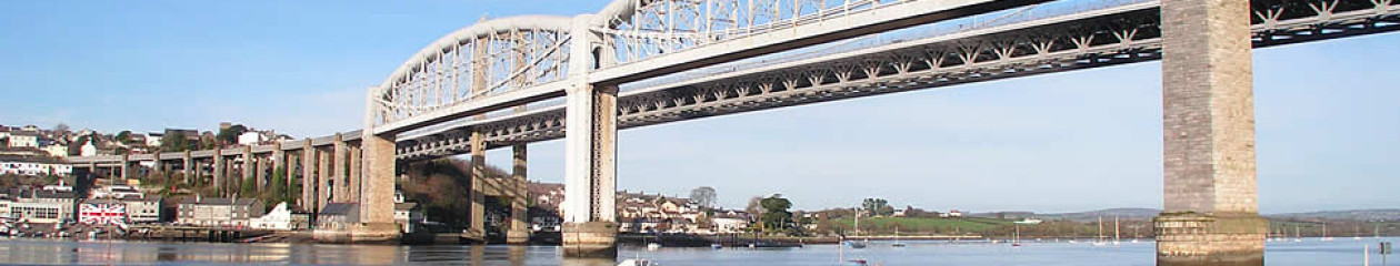
“At the core of the riverside is the area known as ‘Saltash Waterfront’, which in this NDP is defined as the area running north from the Sailing Club, under the Bridges, through to Brunel Green (See Figure 13).’
It is noted that the Saltash Waterfront area on this map on page 39 is shown as a hatched purple area and stops north of the sailing club, but the southern part of this map is obscured by the title.
At figure 18 on page 49 however, where this NDP maps the character areas and historic core of Saltash, the ENV1 area designated as ‘Saltash Waterside’ is shown in red and this is a larger area that extends to include the sailing club and areas south of this. Against this character area of “the waterside” several enhancement opportunities are listed at figure 19 on page 50.
Please could you confirm what is the exact riverside geographical area in this NDP or any future plans for enhancement opportunities, that is being considered. Is the ‘waterfront’ the same area as ’the waterside’ and for development purposes these terms are interchangeable or are they different. Whilst this is a mute point which causes much discussion on social media focusing on Plymouth having a waterfront and Saltash a waterside, however when the terms and their associated areas are to be used in planning decisions, then clarity is required. Especially when the boundaries of these areas appear to be different as shown in 2 maps in the same document.
I would be grateful if someone with an understanding of this area could clarify.
Regards Sarah Young
Hello, thanks for your query. The area shown in Map 13 as the Saltash Waterfront is the area to which policy WF1 applies, which is essentially about setting criteria for the regeneration master plan of the Waterfront area should it come forward. This area is based on the study area defined in the Saltash Waterfront and Coastal Community Team Economic Plan.
The area referred to in Map 18 as the Waterside is the Character Area that was defined in the Cornwall and Scilly Urban Survey, and uses the description in that study. Policy ENV 1 applies in this area, and requires that new development reflects the quality and particular distinctiveness of Saltash’s urban environment, taking into account the information in Figure 19. It includes much of the Waterfront area, but also land to the north and south identified as part of the Character Area which is not within the Waterfront policy area. Note also that the Waterfront policy area also includes some of the Old Town and c1900 Expansion Character Areas.
Both policies apply and put together in the WF 1 Waterfront Area, one more generally covering historic character and local distinctiveness in the wider area, the other being more specific and including more precise guidance in terms of access, parking, residential amenity, landscaping, drainage, environmental impact etc.
I hope this explanation helps.
I have studied the drawings for a proposed waterfront development and I’m afraid they make no sense. They don’t relate to reality at all. Has no one checked them? You really can’t expect the public to vote on such an important document if, clearly, you haven’t prepared it properly. Please reply to this.
Hello, thanks for your comment. Could you please tell me which drawings you are referring to? Is it Fig 13 of the NDP document, or the material on the Saltash Waterfront Team section of this website? That will enable me to contact the right person to give a full reply to you.